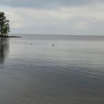
LADOGA LAKE AND VALAAM ISLAND
Ladoga Lake is the biggest lake in Europe. The Neva River flows out of it and into the Gulf of Finland of the Baltic Sea.
The basin of the lake is of glacier origin. Round 12,000 years ago, it fully freed itself of ice. Up to this day the lake is inhabited by seals, which liked its natural habitat.
The square of Ladoga and the islands is more than 18,000 sq km. Boundless expanse of the lake resembles that of a sea. In its open part the shores cannot be seen, while strong winds sometimes turn it into a stormy mess, more dangerous than some of the sea’s. The lake in its longest part is 219 kilometers long, its average width being around 83 kilometers. Average depth is 50 meters. The Svir, Vuoksi and Volkhov, scores of medium and more than a hundred small rivers bring their waters into the lake. Only one – the Neva River, flows out of it.
Ladoga’s shores are multifarious. In the north they are rocky and steep and have complicated relief: they are cut by many bays, peninsulas protruding far into the lake. Here the deepest parts of the lake are concentrated, reaching down to 230 meters. The northern shores and islands of Ladoga have from long ago served as quarries of building and decorative stone. Ladoga’s granite was especially intensively mined during the building of Saint Petersburg. For 150 years it was the main material for monumental building of the Northern Capital. Of Ladoga’s granite, for instance, famous Atlantes of Hermitage are made, the foundation of Isakievsky Cathedral, the Palace Bridge across the Neva, and the pedestal of “One thousand years of Russia” monument in Novgorod.
The southern shores are low, swampy, have mild lineaments and are almost not dissected. Coastal part of the lake is characterized by a flat bottom, its depth being no more than 50 meters. There are three wide bays here that do not protrude into the lake very far and are called Svirskaya, Volkhovskaya and Shlisselburgskaya bays. Parts overgrown with shrubbery are alternated with pine-tree groves, sandy beaches, spreads of pebble-stone and boulders. Layers of limestone come close to the southern shores. The water flowing down the cracks dissolves them and forms cavities and caverns and then breaks out of thick rocks as springs.
In the Ladoga Lake there is a great quantity of islands numbering up to and more than 650. They are distributed unevenly; the biggest part of them is concentrated near the northern shore. In the middle part of the lake there are two archipelagos of islands – Valaam cluster (more than 50) and Mantsinsaari (around 40).
The lake is featured by low mineralization, which makes Ladoga’s water pretty transparent. In the winter time in warm years the Lake does not freeze completely, and the open, central part of the lake remains free from ice. The thickness of ice on the lake depending on the harshness of winter differs from 50 to 110 cm. The ice reaches its deepest thickness in the end of March – beginning of April. The lake begins to open up in April near the southern shore and in the skerries of the northern part. If strong northern winds blow, the masses of ice are driven into the Shlisselburg bay and then into the Neva River. Then the second – Ladoga ice drift flows through it.
The Ladoga is characterized by fierce nature but it is not always fully overridden by the stormy wind. Often, the intensification of wind in one part of the lake goes along with almost still weather in another one. Stills are most common in June, but for a very short time. In July and August, in calm weather mirages happen. As you look into the distance, you suddenly see the islands where there have never been any. Sometimes, instead of an island you can see an outline of a ship on the horizon, or a real island rises up and hovers over the water before your eyes.
Ladoga is known to have ship traffic from the ancient times. In IX-XII centuries, trade route “from the Varangians to the Greeks” passed through here, which connected the North and the South of Russia, Scandinavia and the Baltic area with Byzantium. Transport significance of Ladoga became most intensive during Peter the Great time. Ship docks and canals were built on the shores of the lake. Through a system of canals the Ladoga Lake was connected to the Upper Volga River in the beginning of XVIII century. But bad weather from the days of old was a huge problem for navigation. Sometimes in the mouth of the Volkhov River up to 500 ships would be waiting for favorable weather. It was the reason for building bypass canals on the southern shore of Ladoga.
.
2 комментария
Leave a Comment
You must be logged in to post a comment.


Музей-заповедник ликвидирован в 1992 году. Приемом туристов и паломников занимается монастырь.
Есть еще теперь Природный парк. Его функции не понятны.
Соглашусь с Вами по поводу приема туристов. Меня тоже не пустили в церковь, сославшись на то, что я должен быть в составе группы. На дверях в церковь стоял брутальный мужик, который к тому же еще и курящий. Мне до сх пор интересно, а как же простому, искреннему верующему попасть в церковь? Конечно нам повезло поскольку мы путешествовали с бывшим мэром острова С.В. Григорьевым. У него есть несколько прогулочных катеров и на одном из них мы плавали по Ладожскому озеру. Телефон Сергея Викторовича +7 921 014 44 33