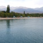
Issyk Kul Lake (Kyrgyzstan)
In Kyrgyzstan there are 2 thousand above the clouds lakes, one of which – Issyk Kul – is a unique place on the planet that is famous for its warm beaches, terminal radon springs, alpine meadows and coniferous forests of the park type. All this beside fascinating magnetic high peaks and glaciers including a big number of the highest mountain verticals.
Mountain non-freezing Issyk Kul Lake, which means “hot lake” in the Kyrgyz language, is located in the north-eastern part of the republic in the northern Tian Shan Mountains between Kungey Alatau and Terskey Alatau at an altitude of 1,607 meters (5,272 ft) above the sea level. Issyk Kul valley has a length of 200 km (124.2 mi), a width of 70 km (43.5 mi). Issyk Kul is surrounded by mountain chains Kungey Alatau in the north and Terskey Alatau in the south. In the valley there’s a rare combination of unique climate: marine, steppe, mountain ones and that of eternal glaciers’ zone.
The lake is endorheic; up to 80 comparatively small streams flow into it; the largest are the Djyrgalan and Tyup flowing in from the east. In the western part the Chu River runs very close to the lake; during spring water-floods the river gives to the lake part of its water through a 6-kilometer long Kutemaldy channel. The level of water in Issyk Kul cyclically changes (rises and then lowers again); a cycle lasts several decades. The water is saltish (mineralization of water is 5.90 %).
The volume of water is 1,738 square kilometers (1079.9 sq. mi), it covers an area of 6,236 square kilometers (2,407.7 sq. mi), the length of the coastal line is 688 kilometers (427.5 mi), the average depth is 278 meters (912 ft), while the maximum depth is 2 and a half times bigger and equals 702 meters (2,303 ft). In some areas on the southern side from village Tamga to village Kadgy-Say signal of an echo depth-sounder sent to measure the depth did not return. Lake Issyk Kul from west to east has a length of 182 kilometers (113 mi), and from south to north a width of up to 60 kilometers (37 mi).
Average temperature of January: Tamga -2° (28.4 ºF), Cholpon-Ata -3° (26.6 ºF), Karakol -6° (21.2 ºF). The average temperature of July is +17° (62.6 ºF).
The amount of hours of sunshine is 2,700, which is more than at the Black Sea. For comparison, the amount of hours of sunshine in Moscow is 1,600.
The first mention of Issyk Kul is found in Chinese chronicles of the end of II century B.C. where it is called Zhe-Hai meaning “hot lake.” Scientific research of the lake, however, began only in XIX century by Russian scientists including N. M. Przhevalsky who willed to be buried on Issyk Kul’s shore.
In 2006, an archeological expedition of Kyrgyz-Russian Slavic University led by Vladimir Ploskikh, vice president of the Kyrgyz Academy of Sciences, discovered the remains of a 2500-year-old advanced civilization at the bottom of the Lake.
Many legends are related to the lake. One of them has it that near the northern shore there is a submerged Armenian monastery where the relics of the Apostle Mathew are buried. For example, on the so called Catalan map dating back to 1375 there is a building with a cross depicted on the northern shore of Issyk Kul with an inscription beside it, “A place called Issyk Kul. On this spot there’s a monastery of Armenian brothers where the body of Mathew the Apostle and Evangelist rests.” In the recent time searching for the monastery and the relics became more active.
Tamerlane appeared on the shores of Issyk Kul at least three times – in 1376, 1389 and 1392. For a long time and without success he tried to subdue the local tribes but all his campaigns had the same result: as the army approached the tribes went away, and when the army left the country the tribes returned.
Setting off for another campaign Tamerlane came to the shores of Issyk Kul. And he ordered each one of his soldiers take one stone and throw it into one pile. And those stones formed a high mountain. When the troops returned from the campaign he wanted to know how many soldiers he still had left. Tamerlane ordered the remaining soldiers each take one stone from the first pile and lay them together into a second pile nearby. And he was grieved because the second pile was much smaller than the first. And the name Santash (“counted stones”) remained – it’s the name of a pass a little east of Issyk Kul.
In the Soviet time archeologists explored the burial mounds in the pass, and it turned out that one of them is a burial of the Sako-Wusun period.
There are also a number of legends about drowned cities and treasures. Most of them are based on real facts. As underwater excavations showed, in the littoral zone of the lake there are, in fact, a number of medieval cities drowned at a later time including the Wusun capitol Chigu.

